to keep commerce moving.
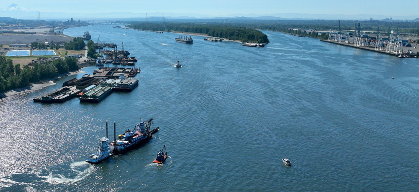
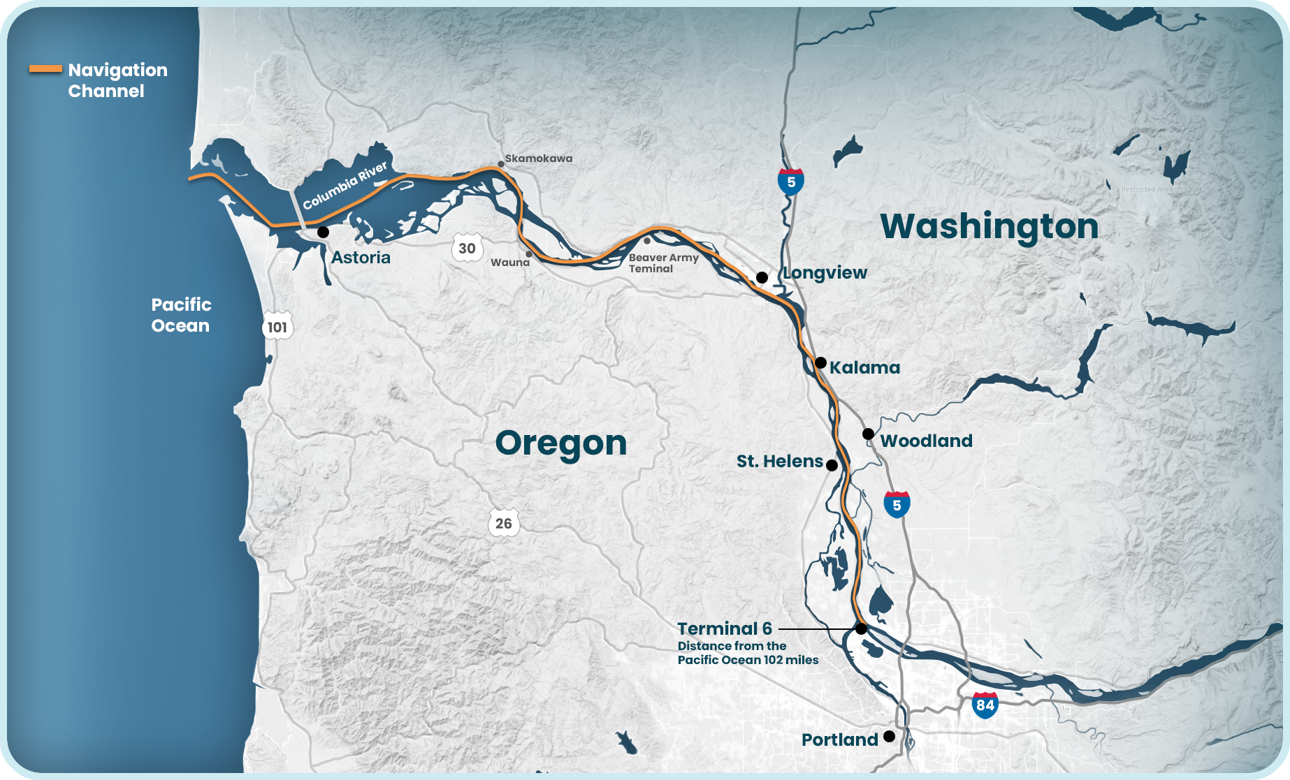
Our marine highways play an important role in Oregon's economic health, creating jobs and ensuring ships can carry goods to and from our region. From the Pacific Ocean to Portland, the Dredge Oregon keeps the shipping channel deep and wide enough for ships, barges, tugs, and other vessels to travel safely and efficiently – to Portland, and beyond.
Navigation
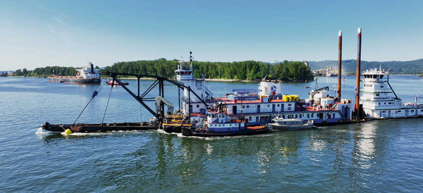
The Columbia River navigation channel begins where the river meets the Pacific Ocean. The Dredge Oregon maintains the channel for 100 miles, starting near Astoria and continuing all the way to the Portland Harbor on the Willamette River.
The region’s gateway for international trade
Local businesses across the Northwest rely on marine shipping to get their products to global markets.
The Dredge Oregon and its crew are critical to the economic success of the entire network of 36 ports in the Columbia-Snake River system.
 Play video
(0:31)
Dredge Oregon 2025
Season Kicks Off
The Dredge Oregon
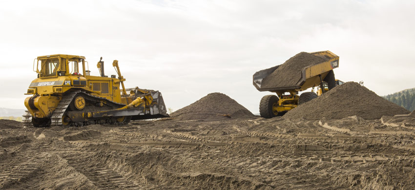
Each year, the Dredge Oregon removes well over a million cubic yards of material – mostly sand and gravel – built up along the bottom of the navigation channel, restoring it to 43 feet deep and 600 feet wide.
This ensures oceangoing vessels can carry goods to and from our region – everything from imported tires, building supplies, consumer electronics, cars, and toys, to exported wheat, produce, seafood, lumber, hay, and sneakers.
How it works
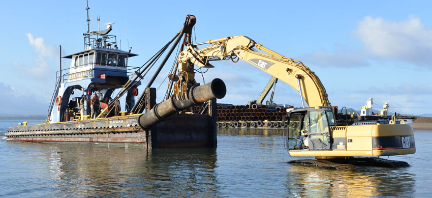
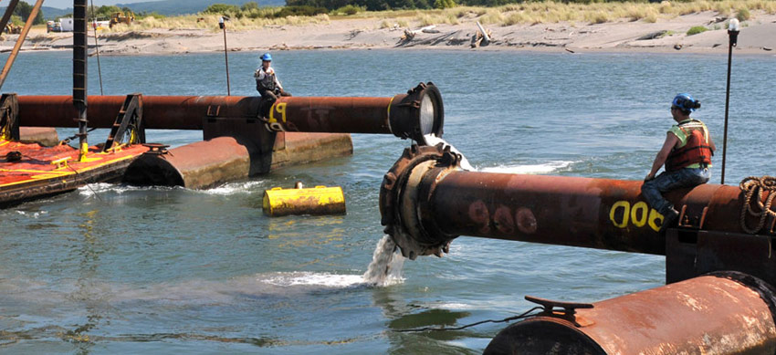
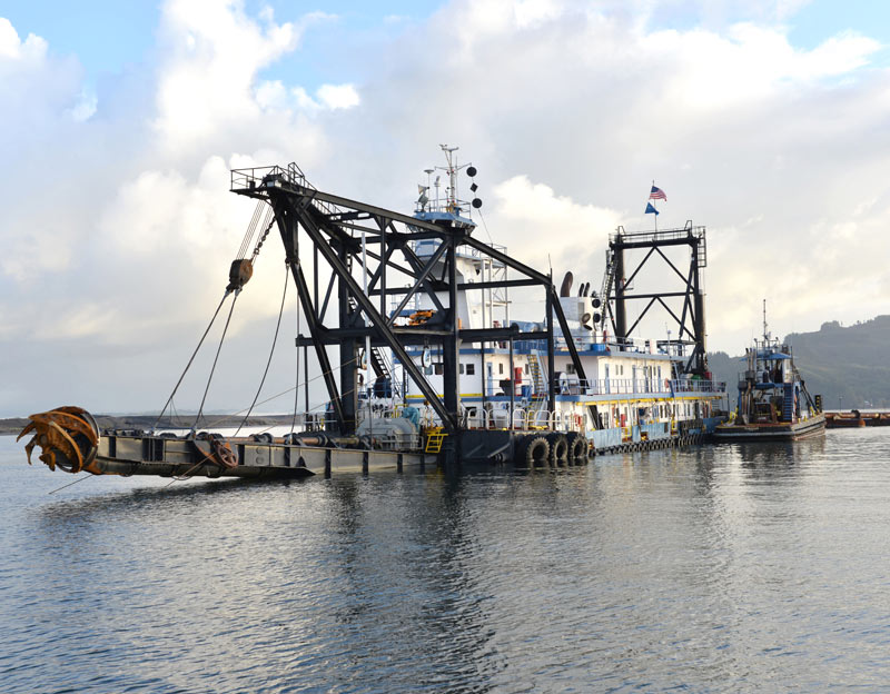
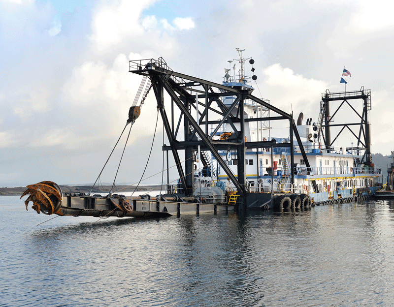
Known as a cutter suction dredge, the Dredge Oregon functions like a massive canister vacuum. The dredge uses a rotating cutter head – essentially a giant egg beater – to stir up and loosen material along the river bottom.
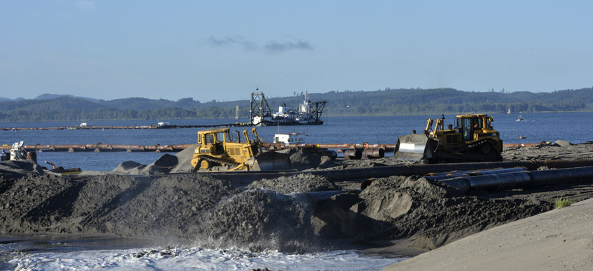
The sand is then sucked up into a 30-inch-diameter pipe and funneled up to 2 miles away to its final destination, whether it’s placed elsewhere in the river, or used to build up islands or replenish eroded beaches.


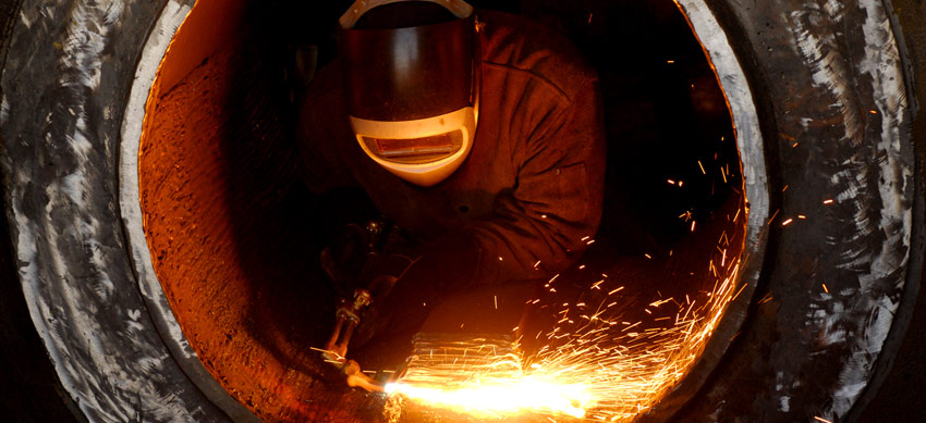
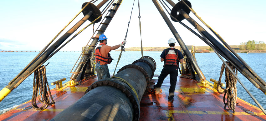
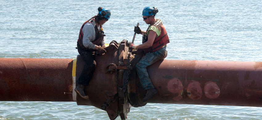
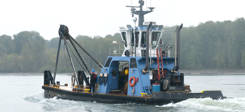
Our crew
Whether a captain or deckhand, or any of the oilers, electricians, boat and heavy-machinery operators, more than 40 people work on the Dredge Oregon, with some jobs out on the water and other positions on shore.
During the annual dredging season (from late spring to late fall), the vessel operates 24 hours a day, six days a week.
Shaping the economy – and our geography
Over the years, dredging has not only shaped the river bottom to accommodate increasingly large cargo ships. It’s also shaped the region’s economy, and even our geography – with dredged materials being used as fill to develop iconic places like Swan Island, Oaks Park, a Multnomah Falls parking lot, PDX, and even the Nike campus.

Dredged material from the river was used to develop Portland-Columbia Airport, now Portland International Airport (PDX), pictured here in 1940.
Dredging through the years
Without dredging the shipping channel, we would be a very different and much smaller city.
Early city and state leaders recognized the importance of transportation infrastructure in the Portland Harbor. They established the Port of Portland in 1891 for the express purpose of dredging the navigation channel from Portland to the sea.
They also made investments in roads, railways, and runways that positioned the city of Portland as an international trade hub. By the mid-1920s, Portland had become the region's gateway for the export of wheat, lumber, wool, and manufactured goods.
Timeline
Contacts
More Information